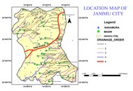
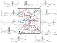
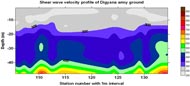
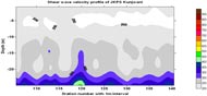
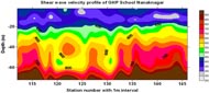
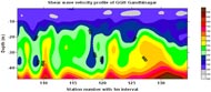
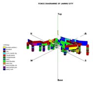
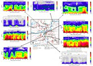
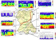
Seismic Microzonation of Jammu Municipal Area in collaboration with Wadia Institute of Himalayan Geology Dehradun.
Click on the images to preview
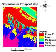
PROJECT-III : Groundwater Prospect Mapping Work of Rajiv Gandhi Drinking Water Mission (RGNDWM) Phase –III of J&K State
Jammu District digital Natural Resources Information of the has been prepared by Integrating the different thematic layers in the GIS environment.
Click on the images to preview
PROJECT-II :NRDMS DST Project /Centre on “Establishing the Natural Resources Digital Database District Centre at Jammu and Creation of an integrated database for Development Planning
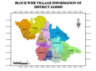
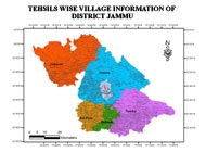
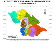
Jammu District digital Resources Profile of Blocks, Tehsils and Constituency up to village Level showing the different assets of Socio-Economic and demography Information ( In GRAM++ and Arc GIS Software) (Scale 1:10 000).
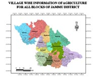
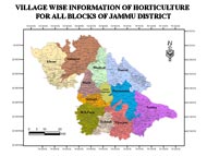
Agriculture Department information (Village wise) regarding area under different crops, source of irrigation, irrigated area, of Jammu District and Horticulture department information (Village wise) regarding area under different types of fruits, production of fruits of Jammu District.
Click on the images to preview
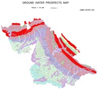
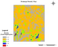
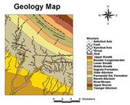
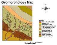
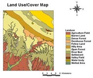
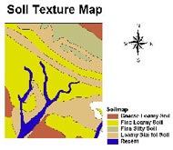
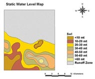
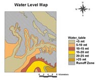
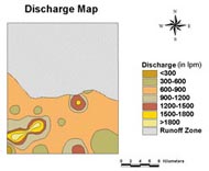
PROJECT-I : Evaluation of Groundwater potential zones using Remote Sensing and GIS Techniques in the Hills Terrain of Devak and Rui Watershed-Jammu District, J&K State
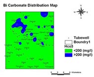
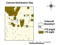
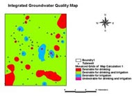
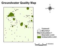
The groundwater prospects map has been prepared by integrating the hydromorphogeological, land cover, slope, drainage frequency, soil, depth to water table (pre-and post-monsoon), water table fluctuation, static water table, discharge, drawdown, specific capacity, transmissivity and hydraulic conductivity maps using Index Overlay Method in the GIS environment. Geographical Information System (GIS) based groundwater quality mapping has been carried out with the help of hydro chemical data generated from water samples collected from the study area.